
Reviewed · PEAK DISTRICT TOURS
Map Reading and Navigation Course in Peak District
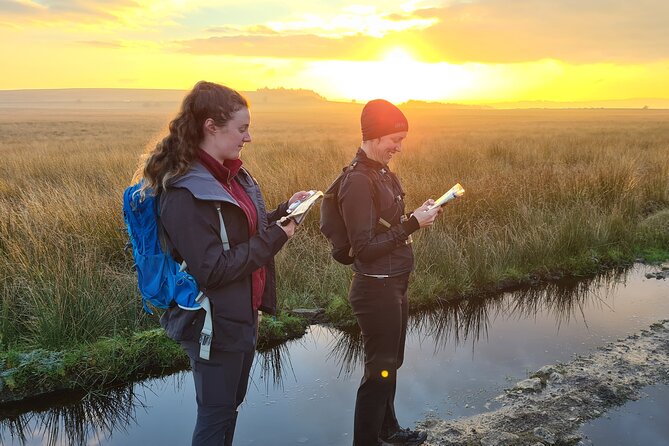
Find your way with confidence. This one-day course turns the Peak District into a practical classroom, giving beginners a useful grounding in maps, compasses, grid references, scales, and rights of way. You begin at The Adventure Hub near Bamford in the Hope Valley, then spend most of the day outside putting each skill to work.
I like the small maximum group of eight, which should give you more time to practise and ask questions. I also like the friendly teaching style, with instructors such as Gavin, Rick, Paul, Richard, and Guy praised for clear explanations and a good sense of fun. The main drawback is that lunch is not included, and the course runs in all weather, so you need to arrive properly dressed and prepared.
In This Review
- Key points to know before booking
- Starting at The Adventure Hub in Bamford
- The morning lesson: maps, scales, and grid references
- Compass practice in the Peak District
- Taking the classroom outside
- What you will actually learn by the end
- A closer look at the teaching style
- Weather, clothing, and lunch
- Is $136.73 good value?
- Who should book this course?
- Booking, cancellation, and practical details
- Should you book the Peak District navigation course?
- FAQ
- Where does the navigation course start?
- How long does the course last?
- Is lunch included?
- What navigation skills are covered?
- Does the course run in bad weather?
- How many people can join the course?
Key points to know before booking
- A practical start for beginners: The course is aimed at people who want to begin taking self-guided walks in the hills.
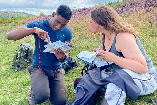
- Most of the day is spent outdoors: You learn a piece of theory at the training facility, then practise navigation in the Peak District.
- Compass skills are central: You learn about different compass types, how to set a map, and how to check direction.
- The teaching is personal: Groups are capped at eight, allowing instructors to adjust explanations and practice to the group.
- Tea and coffee are included: Bring your own lunch, since food is not supplied.
- Plan for British weather: The activity operates in all conditions, so waterproof clothing and suitable footwear matter.
Starting at The Adventure Hub in Bamford
The course begins at 9:30 am in Bamford, in the Hope Valley. Its base at The Adventure Hub places you close to the hills and moorland where the outdoor work takes place, rather than keeping you in a classroom all day.
That setting matters. Map reading makes more sense when you can look from a printed map to the ground in front of you and connect the two. A contour line is no longer just a mark on paper. A right of way becomes something you can identify and follow. A compass bearing becomes a useful check rather than an abstract exercise.
You should allow yourself enough time to reach the meeting point without rushing. The exact transport arrangements are not set out, but the location is near public transportation and parking is available at the Adventure Hub. Your confirmation arrives when you book, unless you reserve within seven days of the date. In that case, confirmation can take up to 48 hours and remains subject to availability.
The base also offers free tea and coffee. It is a small touch, but useful on a full day outside, particularly if the weather is cold or wet.
More Peak District days:
- Outdoor Rock Climbing Taster Day in Peak District
★ 5.0 · 74 reviews - Derbyshire & the Peak District from Manchester
★ 4.5 · 64 reviews - 6hr Small Group Peak District eBike Tour
★ 5.0 · 39 reviews
The morning lesson: maps, scales, and grid references
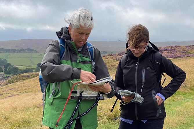
The course begins with the basic tools you need before setting off. You learn how maps work, including scales and grid references, along with the meaning of rights of way.
For a complete beginner, this is the right order. It is tempting to pick up a compass and start pointing it at the horizon, but a compass cannot tell you where you are. First, you need to read the map, work out your position, and understand where a route should take you.
Map scale is another key idea. It tells you how much ground is represented on the page and helps you judge distance. That can be especially useful when you are planning a walk, estimating how long a section may take, or deciding if a route is suitable for your group.
Grid references give you a way to describe a precise position. The course covers their theory and use, then takes those skills outside for practice. This blend of explanation and repetition is important. I would expect some beginners to find the first session slightly technical, but the small group should make it easier to ask for another example before heading outdoors.
Rights of way are also practical rather than decorative. Understanding them helps you work out which paths you can legally use and how routes connect across the hills. You are learning not just how to read a map, but how to make sensible decisions about a real walk.
Compass practice in the Peak District
The compass session covers different types of compasses and how to use them. You learn to set the map, take or check a direction, and use the compass alongside what you can see around you.
The course does not treat the compass as a replacement for map reading. That is good practice. A compass gives direction, but the map provides the wider picture. You need both if you are going to navigate safely and avoid following a straight line toward the wrong feature.
The teaching approach appears to be calm and accessible. Gavin is described as creating a relaxed atmosphere for people who had never tried navigation before. Rick is praised for helping a group that included someone who relied on lip reading, with clear explanations and supportive instruction. Those details suggest that the instructors are willing to adjust their delivery instead of simply racing through a fixed lesson.
Different instructors may lead different dates, so you cannot assume you will have Gavin, Rick, Paul, Richard, or Guy. Still, the repeated praise for several members of the team points to a consistent teaching approach.
You should expect to make mistakes. That is part of the value. It is far better to discover that a bearing or grid reference is wrong during a supervised exercise than halfway through a solo hill walk.
Taking the classroom outside
The best part of the day is the move from theory to practice. The hills and moorland around the Adventure Hub become the working area, and you spend most of the course testing the skills you have just learned.
The exact route is not specified, which is sensible for a navigation course. The focus is not on reaching a famous summit or ticking off a scenic trail. Your instructor can choose suitable ground for exercises and adapt the day to the group.
That also means the views are part of the experience, but they are not the main product. You are there to learn how to relate the map to the ground. You might stop to identify a feature, compare it with the map, check a direction, or work out where you are from several clues.
The Peak District is a strong setting for this sort of tuition. It offers open hills, tracks, trails, and moorland close to the base, so you can practise without spending the whole day getting to and from the exercise area. The natural setting also gives the lesson a clear purpose. You are learning skills that you can use on future walks in the UK.
Expect the day to feel active, but do not book it as a fast-paced hike. Walking is the way you practise navigation, not simply a means of covering distance. Frequent pauses and exercises are likely to be more useful than a long uninterrupted walk.
Something different for another day:
- Stonehenge, Windsor Castle, and Bath from London
★ 4.5 · 18,662 reviews - London Big Bus Hop-On Hop-Off Tour with Optional River Cruise
★ 3.5 · 10,803 reviews - London Small Group Tour of Historical Pubs
★ 5.0 · 10,422 reviews - Beatles Magical Mystery Tour
★ 5.0 · 9,266 reviews
What you will actually learn by the end
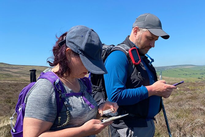
The course is built around the fundamentals. You should finish with a clearer grasp of:
- How to read a walking map
- How map scales relate to real distance
- How to use grid references
- How to identify rights of way
- How to work with different types of compass
- How to orientate a map
- How to check a direction with a compass
- How to link map information with features on the ground
The course is not presented as advanced training. If you already navigate regularly, you may find the one-day format too basic. It is better suited to someone who has never used a map and compass, or someone returning to outdoor walking after a long break.
One particularly useful point comes from a participant who had not seriously used a compass for nearly 40 years. After taking a longer two-day NNAS Bronze course with Pure Outdoor, that person went on to consider the Silver level. The one-day course is not the same qualification course, but the example shows how this kind of instruction can restart an old outdoor skill.
If you use an offline navigation app, the course may still be worthwhile. Digital maps are useful, especially when you have no signal, but a paper map and compass do not depend on a battery. The strongest approach is to understand the basics first, then use digital tools as an extra aid rather than your only plan.
A closer look at the teaching style
The most praised part of the experience is the instruction. The teachers are repeatedly described as clear, supportive, informative, and good fun. That combination is worth noting because navigation can become dry if it is taught as a list of rules.
Paul is praised for making a day of practical exercises both informative and enjoyable. Guy is described as adapting the day to the group and helping participants leave feeling more confident. Richard is singled out for being helpful and good-humoured.
The course also appears suitable for mixed levels within a beginner group. Some people may be starting from zero, while others may be refreshing skills forgotten over many years. A good instructor can give the first person time with the basics without making the second person feel stuck, and the small group size should help.
The disability-aware teaching is another positive point. Clear communication and attention to lip reading needs can make a major difference on an outdoor course. You should still discuss any specific access requirements before booking, since the available information does not describe the terrain or accessibility of every exercise.
Weather, clothing, and lunch
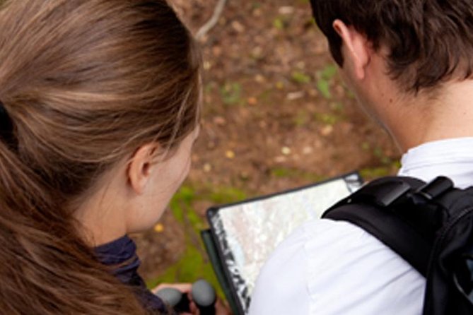
This course operates in all weather. That is not a minor note. The Peak District can feel very different in sunshine, wind, rain, or low cloud, and navigation skills are especially useful when visibility is poor.
Wear waterproof outer layers, sturdy outdoor footwear, and clothing you can adjust through the day. The supplied information does not provide a full kit list, so ask Pure Outdoor what they recommend before you go if you are unsure about equipment.
You need to bring lunch. Tea and coffee are provided, but the course does not include a meal. Pack something practical that you can eat during the outdoor part of the day, along with water.
The weather may become part of the lesson. A clear day makes it easier to match distant features to a map, while poor visibility gives you a better reason to rely on direction, grid references, and careful map work. Still, bad weather can make a full day more tiring, especially if you arrive underdressed.
Is $136.73 good value?
At $136.73 per person, this is not a cheap casual day out. You are paying for a full day, a professional guide, access to instruction in a small group, practical use of the Peak District, and the chance to build a skill you can use on many future walks.
The value depends on your goal. If you simply want a scenic walk with a guide, this is the wrong choice. You may spend too much time stopping to study a map and practise a bearing. If you want to become more independent outdoors, the price is easier to justify.
Private instruction would normally cost more, and a large group would give you less time to practise. The maximum of eight is important here. You are not just listening to a lecture. You are expected to try the techniques, ask questions, and receive corrections.
Tea and coffee are included, but lunch is not, so add the cost of your own food and any transport to Bamford. The course is generally booked 69 days ahead, which suggests you should not leave a popular date until the last minute.
Who should book this course?
I would recommend it to:
- Beginners who want to start walking without a guide
- Walkers who have forgotten old map and compass skills
- People planning more independent hill days
- Anyone looking for a useful outdoor gift
- Visitors who want a practical activity in the Peak District rather than a standard sightseeing trip
It can also suit a couple or small group of friends, provided everyone is comfortable learning at beginner level.
I would hesitate if you already hold strong navigation skills or want a long, uninterrupted hike. The course is about learning, practising, and building confidence. It is not designed as a scenic walking tour with a little navigation added.
Booking, cancellation, and practical details
The activity starts at 9:30 am and ends back at the same meeting point. It lasts approximately one day, and the group can include no more than eight people.
Mobile tickets are accepted, and the course is offered in English. Service animals are allowed, most people can participate, and the base is near public transportation.
You can cancel for a full refund up to 24 hours before the start time. Cancellations or changes made less than 24 hours before the start are not accepted for a refund. The course requires a minimum number of participants, so if Pure Outdoor cancels because that number is not reached, you will be offered another date or experience, or a full refund.
Should you book the Peak District navigation course?
Book it if you want the confidence to leave marked routes and plan your own walks with better judgement. The strongest reasons are the practical outdoor format, the small group, and the consistently warm teaching style associated with instructors including Gavin, Rick, Paul, Richard, and Guy.
Bring lunch, expect changing weather, and understand that the day will include study as well as walking. If you want a useful foundation in maps, grid references, and compass work, $136.73 is a fair price for a focused day that could make many future hikes safer and more enjoyable.
FAQ
Where does the navigation course start?
The course starts in Bamford, Hope Valley, at 9:30 am. The activity ends back at the same meeting point.
How long does the course last?
It lasts one day, approximately.
Is lunch included?
No. Coffee and tea are provided, but you need to bring your own lunch.
What navigation skills are covered?
The course covers maps, grid references, scales, rights of way, different types of compasses, setting a map, and checking direction with a compass.
Does the course run in bad weather?
Yes. It operates in all weather conditions, so you should dress appropriately for outdoor activity.
How many people can join the course?
The maximum group size is eight participants.
Just added around England
- The Private British Museum Tour★ 5.0 · 6 reviews
- London to Southampton Cruise Port | Private Transfer★ 5.0 · 6 reviews
- London’s Chinatown Food Experience★ 4.0 · 6 reviews
- Christmas in Canterbury, Dover and Greenwich with Christmas Lunch★ 4.5 · 6 reviews
- Transfer from Heathrow Airport to London hotel on private car★ 4.5 · 6 reviews
- London Gatwick (LGW) Airport Departure Private Transfer – Hotel to Airport★ 4.0 · 6 reviews
- Bristol private pub hopping and sightseeing with local guide★ 5.0 · 6 reviews
- Isle of Wight Tour App, Hidden Gems Game and Big Britain Quiz (7 Day Pass) UK★ 4.0 · 6 reviews
Peak District Tours, compared.
Outdoor Rock Climbing Taster Day in Peak District
Read our review →

Chatsworth and Peak District Small-Group Tour from Manchester
Read our review →
Browse the lists this tour appears in